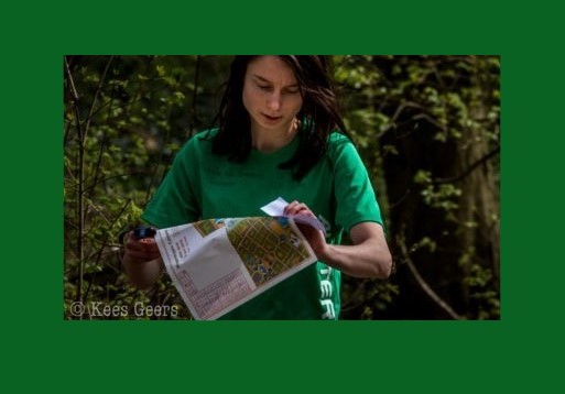
You wanna go out and have some fun? Then you are in the correct spot. Here you will find a list of routes where you have to orient yourself on a map and find specific points. This is a test of your map reading skills in all kinds of different terrain. The goal is to travel as fast as possible around the route set out, with only a map and a compass to guide you. At each labeled point on the map, there will be a marker that you will find when you are in the right place. The marker will often look like this or something similar (the city routes are laid with AT stickers) and on the map, it will show you where this point is.
It is up to you to choose your route between these ‘checkpoints’, sometimes cutting straight to the point through the forest is faster, other times navigation is easier on the pathways.
This website has a very good overview of orienteering and can explain some details on a map. For a list of IOF control descriptions (the symbols on the legend on the side of some maps), see this document. The symbols in boxes give more precise details how to find the exact location of a checkpoint.
It’s much more challenging than just going for a run and requires mapreading skills and some thought!
So take the map with you, either printed or on your phone (although a printed map is much nicer), and a compass (also on your smartphone) and you have a different kind of training you can do alone, out in the sun.
If you complete a run and cannot find some of the markers, please let the board know via the AT app or email. Occasionally they are removed by curious members of the public, and if we know they are missing then we can replace them.
The following routes are currently set out and ready to go:
- Orienteering Best, startpoint here, length is approximately 8km. Time to beat is 48 minutes.
- Orienteering Grooteheide Zuid V2, startpoint here, 8km.
- Orienteering Einderheide, startpoint here, 8km. Fastest time is currently 52 minutes.
- Orienteering Oirschotse Heide, startpoint here. Approximately 10km and running over sand- hard work! Note; at this point in time, marker no. 6 is missing. It will be replaced soon!
- Downtown Eindhoven, startpoint here, 8km. Please read/ download the IOF control description document mentioned above, you will need the symbols for this run! The checkpoints are AT stickers, and you may need to look around a little to find some of them.
- Villapark Zuid, startpoint here. Please read/ download the IOF control description document mentioned above, you will need the symbols for this run! The checkpoints are the new AT stickers, and you may need to look around a little to find some of them.
- TUe Rogaine, startpoint and end is at the AT shed on campus. This is a different style of orienteering: you have a set time to collect as many points as you can, and checkpoints are worth different points. This encourages you to plan your route. The time for this route is 50 minutes. It is very important to be within time; you lose 50 points per minute late! The checkpoints are white paper strips with a code on them- write the code on this document: TUe Rogaine symbols. The last column here specifies the number of points each checkpoint is worth, as do the number in brackets on the map.This document also contains the IOF control descriptions of each checkpoint, so make sure you take this document with you as well). The current record is 455 points within 50 minutes!
Old runs that are no longer set out at this point in time:
- Orienteering Grooteheide Zuid V1, 8km, startpoint approximately here. Fastest time: 45:50
